


SALEM - T 8 Voting District, Kenosha County, Wisconsin
About
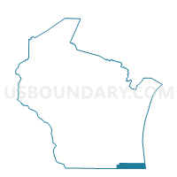
Outline

Summary
| Unique Area Identifier | 694349 |
| Name | SALEM - T 8 Voting District |
| County | Kenosha County |
| State | Wisconsin |
| Area (square miles) | 4.85 |
| Land Area (square miles) | 4.32 |
| Water Area (square miles) | 0.53 |
| % of Land Area | 89.09 |
| % of Water Area | 10.91 |
| Latitude of the Internal Point | 42.51927830 |
| Longtitude of the Internal Point | -88.17202210 |
Maps


Graphs
Select a template below for downloading or customizing gragh for SALEM - T 8 Voting District, Kenosha County, Wisconsin


Neighbors
Neighoring Voting District (by Name) Neighboring Voting District on the Map
- ANTIOCH 1 Voting District, Lake County, IL
- RANDALL - T 1 Voting District, Kenosha County, WI
- RANDALL - T 4 Voting District, Kenosha County, WI
- SALEM - T 10 Voting District, Kenosha County, WI
- SALEM - T 4 Voting District, Kenosha County, WI
- SALEM - T 6 Voting District, Kenosha County, WI
- SALEM - T 9 Voting District, Kenosha County, WI
- Silver Lake - V 1 Voting District, Kenosha County, WI
- Silver Lake - V 2 Voting District, Kenosha County, WI
Top 10 Neighboring County Subdivision (by Population) Neighboring County Subdivision on the Map
- Antioch township, Lake County, IL (27,745)
- Salem town, Kenosha County, WI (12,067)
- Randall town, Kenosha County, WI (3,180)
- Silver Lake village, Kenosha County, WI (2,411)
Top 10 Neighboring Place (by Population) Neighboring Place on the Map
- Camp Lake CDP, WI (3,665)
- Silver Lake village, WI (2,411)
- Channel Lake CDP, IL (1,664)
- Wilmot CDP, WI (442)
Top 10 Neighboring Elementary School District (by Population) Neighboring Elementary School District on the Map
- Antioch Community Consolidated School District 34, IL (23,861)
- Randall Joint No. 1 School District, WI (5,299)
- Wheatland Joint No. 1 School District, WI (4,166)
- Silver Lake Joint No. 1 School District, WI (4,046)
- Trevor-Wilmot Consolidated School District, WI (3,995)
Top 10 Neighboring Secondary School District (by Population) Neighboring Secondary School District on the Map
- Antioch Community High School District 117, IL (45,037)
- Wilmot Union High School District, WI (18,722)
Top 10 Neighboring State Legislative District Lower Chamber (by Population) Neighboring State Legislative District Lower Chamber on the Map
Top 10 Neighboring State Legislative District Upper Chamber (by Population) Neighboring State Legislative District Upper Chamber on the Map
Top 10 Neighboring 111th Congressional District (by Population) Neighboring 111th Congressional District on the Map
Top 10 Neighboring Census Tract (by Population) Neighboring Census Tract on the Map
- Census Tract 29.04, Kenosha County, WI (5,500)
- Census Tract 30.02, Kenosha County, WI (4,863)
- Census Tract 29.03, Kenosha County, WI (3,210)
- Census Tract 8608.05, Lake County, IL (1,693)
Top 10 Neighboring 5-Digit ZIP Code Tabulation Area (by Population) Neighboring 5-Digit ZIP Code Tabulation Area on the Map
- 53105, WI (29,225)
- 60002, IL (24,299)
- 53168, WI (8,643)
- 53181, WI (7,357)
- 53179, WI (6,310)
- 53170, WI (2,380)
- 53192, WI (217)